National Park
The rivers
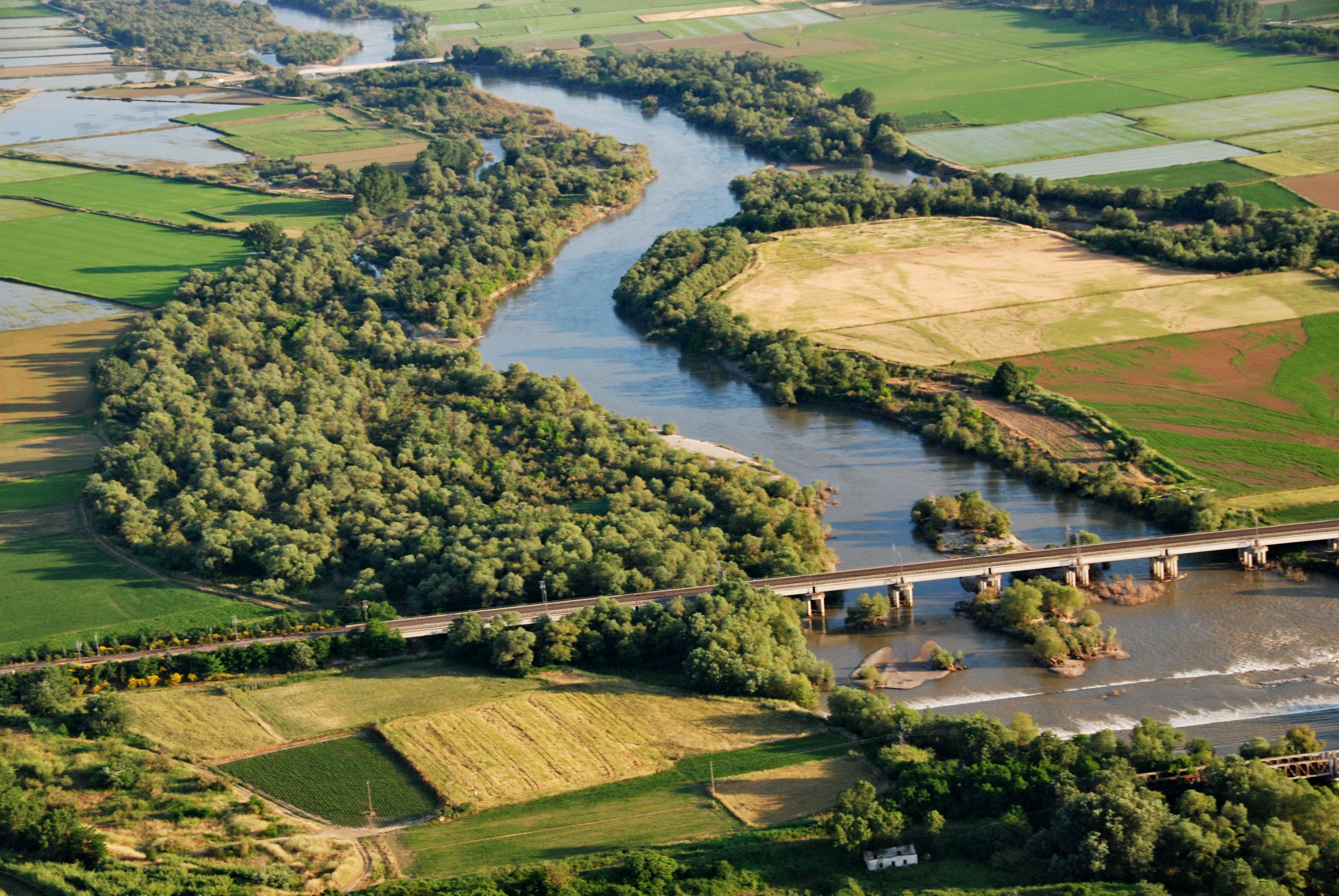
Τhe Gallikos river

The Gallikos river mouth Nondas Stylianidis
The Gallikos river springs from the Krousia mountains, at Kilkis. Following a route of 65 km, it flows into the Thermaic gulf. In antiquity it was called Echedoros, ‘the one bearing gifts’, as its riverbed contained traces of gold. Herodotus mentions that when Xerxes travelled through Macedonia on his way to Greece, his army drank all of the river’s water and dried it up!
The Gallikos river does not maintain a steady surface flow in a large part of its bed, due to the long years of exploitation of its water resources. The Gallikos river was ‘resurrected’ during recent years thanks to the Aliakmon river! Large quantities of water, intended to supply the urban complex of Thessaloniki were superfluous and therefore driven towards the riverbed of the Gallikos.
At the Gallikos estuary we meet a system of three large pools, created from soil extractions of previous decades. These ‘ponds’ were created accidently, but they are today full of life, as they are home to coots, cormorants, pygmy cormorants, rare species of herons as well as ducks, Dalmatian pelicans, flamingos, swans and buzzards in the winter.
The Axios river
The Axios river Lia Papadranga
The Axios is the second longest river in Greece and the second longest river in the Balkans, with a length of 380 km, of which 76 km winds through Greece.
It emanates from the Former Yugoslavic Republic of Macedonia, as well as from the Varnounda mountain in the department of Florina, and flows into the Thermaic gulf, constituting the main supplier of fresh water and sediments in the the gulf.
Homer called it vathydinin and euryreonta, meaning that it is deep, forms whirlpools and has a broad bed. In FYROM, where lies its larger section, the river is called Vardaris, while in Greece the word Vardaris stands for the north-west wind blowing along the valley of the Axios river.
At the beginning of the 20th century, the Axios used to flow into a few kilometers to the south-west of Thessaloniki, therefore threatening to cut off the port’s access to the sea, due to the continuous sedimentation of the Thermaic gulf. In the 1930’s, the riverbed was transferred through technical works, into its present location. Since then, the river delta has become an extended deltaic plain. However, recent measurements show that over the past 30 years, the delta is being eroded, due to a reduction in the river’s water supply and sediment discharge. Thirteen dams exist along the bed of the Axios river, twelve of which concern its confluents in the FYROM.
In spring and summer, the riparian forests and aits of the Axios gather thousands of pairs of herons, who reproduce: little egrets, grey herons, night herons, spoonbills and great white herons, which form, along with glossy ibises, pygmy cormorants and cormorants, one of the largest mixed birds colonies in Greece.
The Loudias river

The Loudias river mouth Giorgos Xatzispyrou
In the past, the Loudias river would group the waters emanating from the mountains Voras, Vermio and Paiko. These waters would end up in the lake of Giannitsa and continue their course from there, towards the Thermaic gulf. Today, following the draining of the lake of Giannitsa, Loudias is no longer a natural river, but basically an artificial canal, 40 km. long, receiving the water from the plain of Giannitsa and from part of Imathia plain. It was opened in the 1930’s, during the works for the draining of the lake of Giannitsa.
The Aliakmon river
The Aliakmon river Delta Giannis Kobatsiaris
The Aliakmon is the longest river in Greece. From its sources in mount Grammos and Voios, it traverses approximately 350 km before it flows into the Thermaic gulf. Trench 66, which is 35 km long, also flows into the Aliakmon. Trench 66 was designed to receive part of the water coming from the drainage network of the former lake of Giannitsa.
Aliakmon has an extended delta, which is refuge for numerous wildlife species, thanks to its difficulty of access and therefore limited human presence. Among these species, one can find one of the few pairs of white-tailed sea eagles in Greece. To the south of the Aliakmon delta lies the wetland of Nea Agathoupoli, which is known for the thousands of ducks that it hosts, mainly during winter months.
TABLE: The National Park rivers in numbers
| Gallikos | Axios | Loudias | Aliakmon | |
| Length (km) | 65 | 380 (76 on Hellenic soil) | 39 | 350 |
| Catchment area (km2) | 1022 | 24000 (1614 on Hellenic soil) | 1409 | 21200 |
| Mean annual supply (m3/s) | 39.5 | 158 | 23 | 73 |
| Minimum annual supply (m3/s) | 49 | 21 | ||
| Maximum annual supply (m3/s) | 279 | 137 |
Sources: ΑΝΕΘ – ΟΡΘΕ 2002, Poulos et.al. 2000.
SOURCES
Karageorgis Α.P., M.S. Skourtos, V. Kapsimalis, A.D. Kontogianni, N.Th. Skoulikidis, K. Pagou, N. P. Nikolaidis, P. Drakopoulou, B. Zanou, H. Karamanos, Z. Levkov, Ch. Anagnostou, 2005. An integrated approach to watershed management within framework: Axios River catchment and Thermaikos Gulf. Regional Environmental Change (2005) 5: 138–160
Poulos S.E., G.Th. Chronis, M.B. Collins, V. Lykousis, 2000. Thermaikos Gulf Coastal System, NW Aegean Sea: an overview of waterrsediment fluxes in relation to air–land–ocean interactions and human activities. Journal of Marine Systems 25_2000. 47–76